The excursion to Tre Pizzi Hill
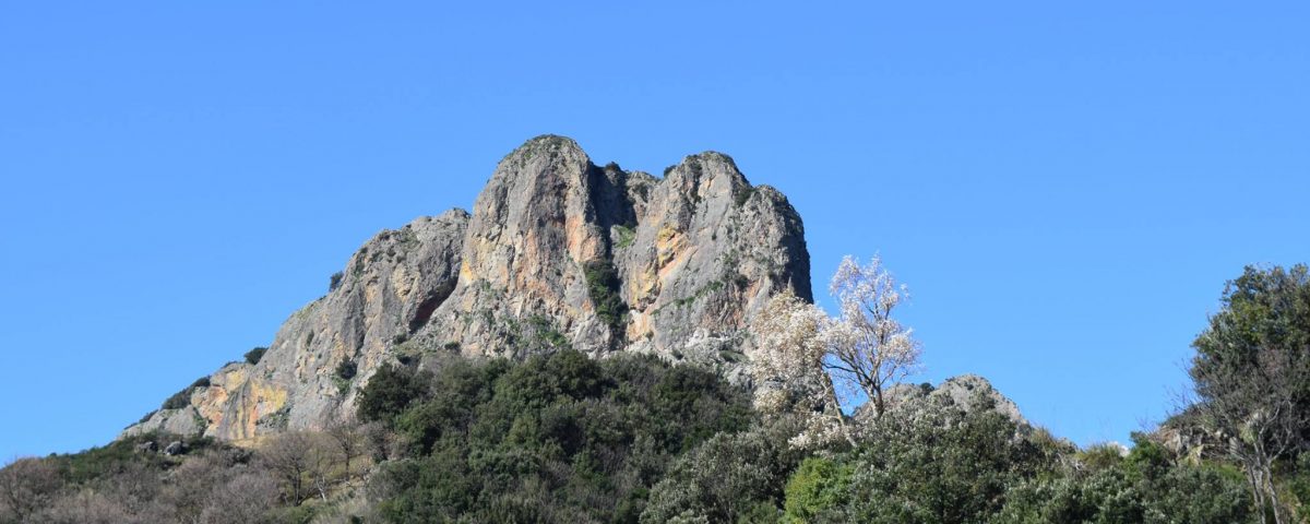
Discovering one of the “stones” that characterize the Ionian side of the southernmost mountain in Italy, the Aspromonte. Mount Tre Pizzi appears as a mighty rock https://it.wikipedia.org/wiki/Costa_dei_Gelsominibastion stretching out towards the valleys below, so named for its particular formation consisting of three granite rock towers, a monolith in the shape of three fingers.
Our excursion starts from Antonimina. From here along dirt roads and paths, we will reach the crest of Monte Tre Pizzi. We will initially cross plots of land used for the cultivation of cereals and forage for livestock, meadows and hills. As you go up in altitude, the Mediterranean scrub made up of heather, myrtle, broom, mastic, strawberry trees and all the typical plants of the scrub and low altitudes of the Aspromonte, olive groves and other crops kept on by low walls dry. Thus begins the forest, holm oak, oak and pine, which alternate making the colors of the vegetation change step by step.
Reached the altitude of 752 m., the path will be easier, with some short ups and downs. Arrived at the top, we will look out from the “Terrezza” with a view of the Costa dei Gelsomini, the view will be incomparable, from the fortress of Gerace, then continuing from the heights of Pietra Cappa and the top of Montalto up to the Limina, much of the Aspromonte Ionico will be visible. At the foot of the mountain, as evidenced by some ruins, there is a convent of hermit friars which most likely dates back to the twelfth century, the mountain until a few centuries ago was a destination for pilgrims from all over Locride on the occasion of the annual livestock fair in honor of St. Peter.
The return will be along a path that passes under the highest peak of Tre Pizzi, we will meet the classic Mediterranean scrub, some herds of goats and sheep in the semi-wild state, and passing through the “Grutta du mutu“, refuge of an old hermit shepherd , as the legend tells, to lead us to the locality Zefrò, an area mainly cultivated with olive trees and cereals.
Continuing the descent we will head towards the town of Antonimina where our excursion will end.
Duration: about 6 hours
Length: 11 km
Difficulty: medium / high


